The next generation of GIS

A modern perspective of...

location_on

GIS Consulting

We Collect, Integrate, Analyse and Visualise your Spatial Data. We deliver high quality service in the most cost-efficient way.

stay_current_portrait

Web & Mobile

Our expertise in Spatial Web and Mobile development allows us to offer custom solutions optimized for Smartphone, Tablet and Browser.

shuffle

Commercial & Open Source

As experts in GIS, we specialize in the use of Commercial and Open Source technologies to deliver enterprise ready GIS solutions.


Software Development

Projectsmore_vert
Projectsclose
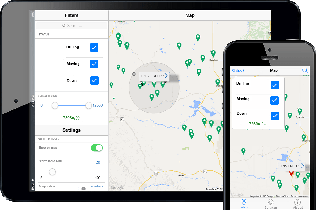
GeoActivity Maps

User friendly notification service with daily alerts, reports and maps on well licenses, spuds (drilling wells) and land sales. It uses the most current information for client areas of interest such as Provinces (Alberta, Saskatchewan, British Columbia and Manitoba), PSAC or User-Defined areas.

GeoActivity Rigs

Best Rig Locator in Western Canada. It provides accurate locations and status about Western Canada’s drilling rigs.

Technology - We will use the technology that best fit our client requirements and budget. We work with many vendors and always use the technology that best fits the purpose, using commercial, open source or a combination of both. We always obtain the same result: High Quality Apps!

User Experience - We deliver elegant and modern apps with superior performance for the web or any other devices such as tablets and phones. Our apps always exceed client expectation!

Performance - As part of the user experience, every single layer of our apps is optimized for speed. Our cloud servers are resilient to failure granting our client continuity in their service

Scalability - We can enable your GIS app servers to support few to millions devices. The servers will Scale Out or Scale In based on usage automatically. Our client pay depending on usage

Offline Sync - We can enable your GIS apps to work even when they are offline. By cashing server data locally on the devices, your apps are still useful and responsive in case of network issues
Spatial Analysis


Spatial Analysis shows where thing are and how they are connected. It is at the core of any GIS system and allows to find geographic patterns and relation between features.

Vectors

  • Spatial queries
  • Spatial Joins
  • Map Overlays

Rasters

  • Surfaces
  • Statistics - Local, Neighborhood, Zonal and Global
  • Network - Optimum routes
  • Network - Closest facility and Service Area
Conservation Projectmore_vert
Conservation Project close

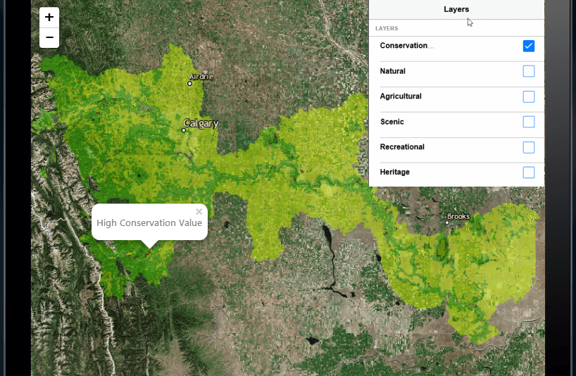
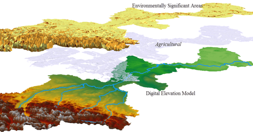
A conservation priority model for Bow River Watershed was developed, five criteria’s were weighed in order to classify every LSD. Five layers (Natural, Agricultural, Scenic, Recreational, and Heritage) were created, classified and a final conservation layer was derived from a weighed overlay. the output of this analysis was presented using two apps(Android & iOS)


Data Management


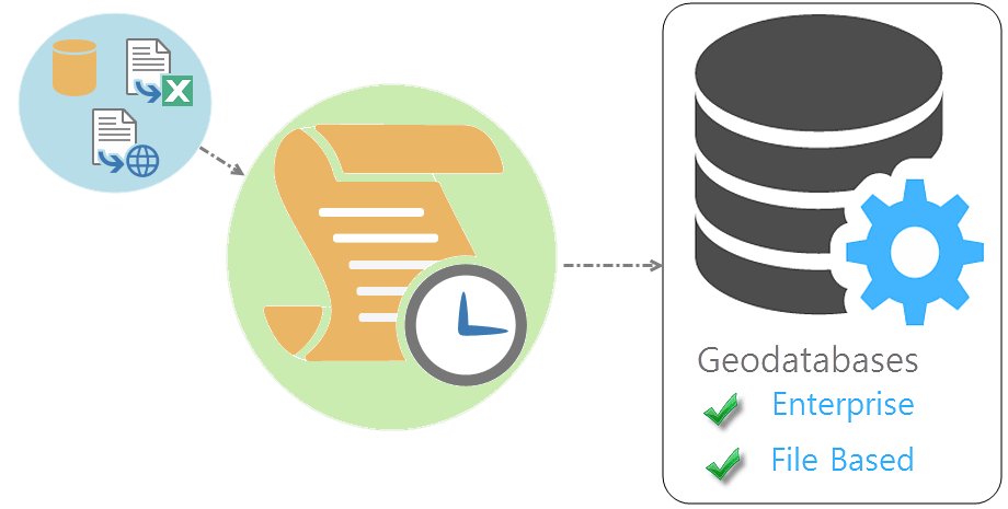
Collect: We collect raw data from different formats. We enhance your information with high quality publicly available data.

Extract: Relevant data is extracted and enriched.

Transform: We create highly automated routines to convert data between differents formats. We perform transformations such as reprojections and data convertions. We automate processes using Python, ModelBuilder and FME.

Load: Once data is ready, we load it to spatially enabled enterprise geodatabases (PostgreSQL/PostGIS, MS SQL, Oracle Spatial, ArcSDE) or file based geodatabases.